Day 53 – Petoskey to Traverse City

66 miles. Some on a nice, paved bike path and some battling with traffic for a share of the narrow shoulder.

It wasn’t hard to get up this morning. Some of our fellow guests were packing up their car at 5 AM and had a high decibel conversation about luggage right outside our door! So, after a healthy breakfast of sweet rolls and waffles, we headed down the big hill that depressed us coming up last night. At the bottom of the hill we joined the Little Traverse Wheelway that took us 19 miles to Charlevoix. The path was nicely paved and followed highway 31 all the way – a stress free way to start the day’s ride. After Charlevoix the fun began as the route jumped on and off the highway that had, at times, a wide comfortable shoulder and at others, no shoulder at all.

image.jpeg

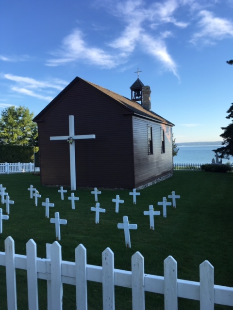
St. Francis Solanus church on the lake in Petoskey. It is the oldest public building in lower Michigan and was started by a priest known as the “Snowshoe Priest.”

Our maps told us to get off the highway onto a bike friendly side road named US Bike Route 35! It was a country road in pretty bad condition with hills but at least there was no traffic. We stopped for snack at the top of a hill and as soon as we started up again, the pot holed paved road gave way to a rocky dirt road! Not what we were looking for at all. We pushed on and turned onto a paved road as soon as we could and headed back to good old highway 31.

image.jpeg

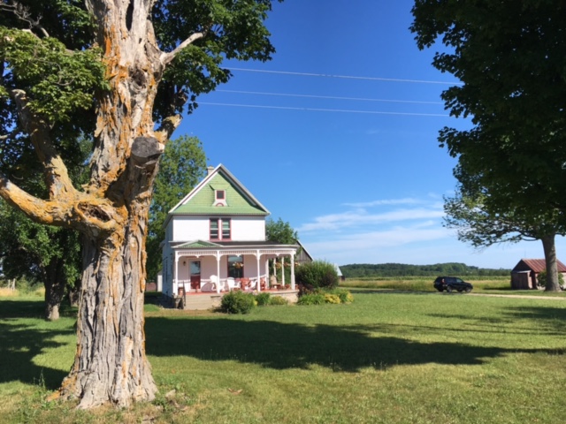
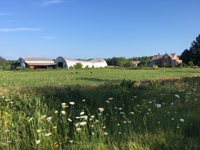
Pink and green farmhouse on the side road before it turned into a rocky dirt road.

image.jpeg

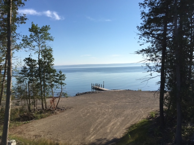
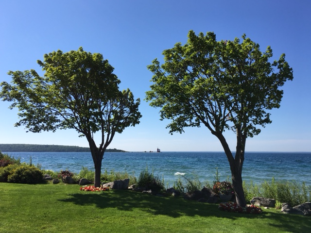
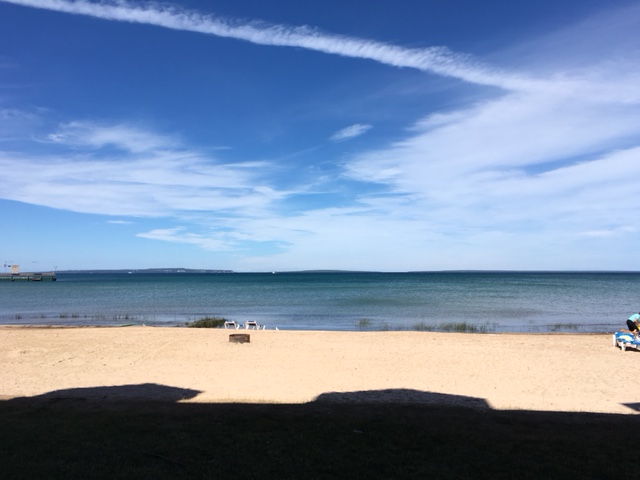
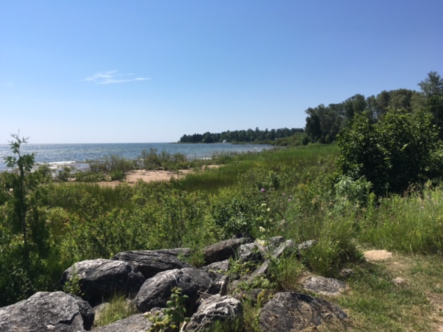
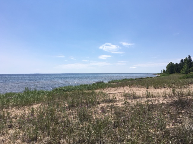
This lakeside parcel was being developed for homes. Note how smooth Lake Michigan was this morning.

But we survived and eventually hooked up with the TART (Traverse Area Recreational Trail), another well paved bike path that took us right to the back door of our hotel. It is very high season here and a weekend so we paid a hefty premium for our more or less basic hotel room. We considered ourselves lucky to find this one since the various hotel booking websites said the town was sold out!

image.jpeg

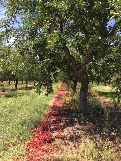
A lot of sour cherries just left on the ground!

We checked in and then decided to unload the bikes and go exploring to see Traverse City. The TART took us to the downtown which is filled with restaurants, fudge shops and gift shops, just like most resort towns. We took a side street in the old part of the town and we’re happy to find a brick, tree lined street with large, old Victorian houses on both sides, all well maintained and with manicured lawns.

Tomorrow we head south to Cadillac and we are expecting some rain early and headwinds.

image.jpeg

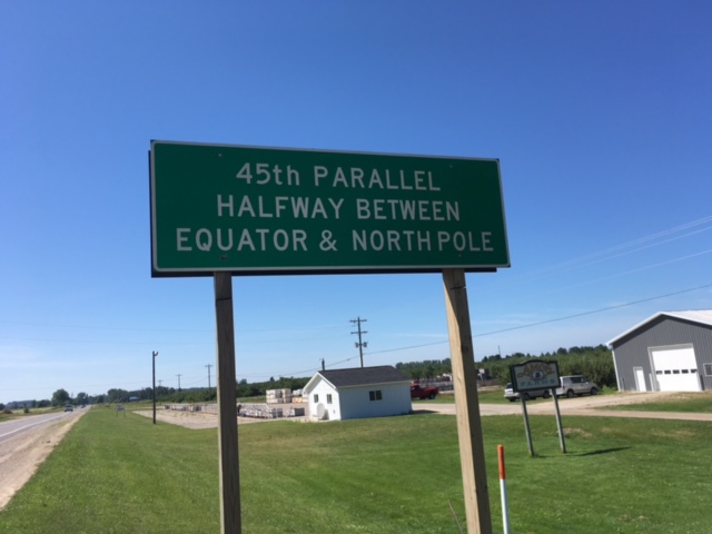
This sign made us think about how the US relates geographically to the rest of the world!


Day 52 – Mackinaw City to Petoskey

40 miles.  Also biked 9 miles around Mackinac Island

image.jpeg

The approach to Mackinac Island by ferry

After breakfast we boarded a ferry with our bikes and a lot of other tourists for the ride to Mackinac Island including a brief sail under the Mackinac Bridge.

image.jpeg

Sailing under the span of the Mackinac Bridge

The island is car free and home to many Victorian homes of wealthy 19th century industrialists. The Grand Hotel boasts the longest porch in the world! It’s 9 miles around the island so it didn’t take us long to circumnavigate but by the time we finished the tourist population had blossomed! There are a ton of fudge shops, gift shops, restaurants, etc. as well as bike rental shops.

image.jpeg

No cars are allowed on Mackinac Island. Deliveries are made by horse drayage

Two of the private houses on Mackinac Island.

After our quick tour we boarded the ferry back to the mainland and got underway toward Petoskey. The first part of the ride was on a shaded bike path and the paved surface quickly gave way to crushed limestone, in places so thick that it was difficult to make good time. We switched over to Highway 31 that paralleled the path and rode on the shoulder for most of the rest of the way.  One woman yelled at us from her car that we should be on the bike path and a gentleman stopped his car to point out that the bike path was “right there.”  We preferred making better time to plowing through the gravel so stayed on the highway until a paved path took us the rest of the way into Petoskey.

The “dome” of hot air is still to our south but today was certainly warm and muggy. We made our usual stop for ice cream then had to pedal up a fairly steep hill to get to our hotel. “Not fair,” we cried.

image.jpeg

Many cairns populate the rocky shore on the island.

Tomorrow we continue south to Traverse City, the cherry capital of Michigan, and then turn back east on the following days.

image.jpeg


Day 51 – Manistique to Macinaw City

93 miles. Includes the 5 miles lift across the bridge from the Bridge Authority

The day started with the threat of high winds, heavy rain and hail! We had joked yesterday that we wanted a 60 mph tail wind and it looked like we were going to get our wish. We rode for a few hours under overcast skies with a pleasant but not gale force tail wind. It was enough of a boost to up our average speed to 15 mph when we usually are doing 13 or so. But then the rains came! We have been very lucky on this trip having only a brief 40 minute sprinkle so far in the entire 50 days. Today’s sprinkle was a downpour for about an hour then drizzle for two more hours or so. We put on our rain gear and pedaled through. The good news is that it’s only water… We got wet but our Ortlieb panniers kept our gear dry through it all. And the strong wind and hail never materialized. At one point, just as the rain was getting very heavy, a car pulled off in front of us with its flashers on. A woman got out of the passenger side and waved us to a stop. All of us now standing in the deluge she said she and her husband want to take a long bike trip and they wanted to know what it was like biking in the rain! Wet!

image

The surf was up on Lake Michigan but that didn’t keep these people from jumping in.

We stopped at a rest stop and met a woman who give us her input about Mackinac Island and the road down to Traverse City (and so much more!) and after that time, the rain pretty much went away. Thanks to our speed earlier in the day we decided to coast on by our planned hotel in Epoufette and set out sights on St. Ignace (pronounced “Ignis” around here) and maybe the bridge over to Mackinaw City. Both Mackinac and Mackinaw are pronounced the same – mackinaw.

image

We had cheese curds and kringles in Wisconsin and now a pasty in Michigan. The “a” is pronounced as in “cat” so don’t get the term confused! Pasties are baked pastries filled with meat and potatoes and originated in Cornwall in the UK. This shop is known for the quality of their crust.

Cyclists are not allowed on the bridge so we paid $5 each to have a bridge employee drive us and our bikes across the bridge to Mackinaw City and he dropped us off there.

image.jpeg

View from the St. Ignace shore of the Mackinac Bridge. Here’s a brief history of the bridge, the longest suspension bridge between two anchorages in the Western Hemisphere.

image

From inside the truck that carried us across.

Tomorrow we will take an early ferry over to Mackinac Island and circumnavigate the place – no cars allowed – then return and start pedaling south toward Petoskey.

image

The beach immediately off our hotel room!


Day 50 – Escanaba to Manistique

59 miles. Includes a little detour first thing this morning while we were “temporarily confused.”

The Wells FarGold Fish in Escanaba, MI

Another reminder that fishing is king around here. This guy is in front of the Wells Fargo branch in Escanaba.

We slept in a little this morning since we knew we had a relatively “short” day ahead. The weather was sunny and we had a little tail wind all day… the wind wasn’t always right at our backs but it was seldom in our faces. After a run to the north, Rte. 2 headed east across the UP following the Lake Michigan shoreline. For the most part we had a generous and smooth shoulder to ride on but oh, the trucks!!! This is logging territory so there were many heavily laden log trucks with upwards of ten axles meaning at least 40 tires all whining as they zoomed by. Big rigs used to be 18 wheelers but 40+ generate a lot of noise and wind. As I said, we had a wide and smooth shoulder to ride on so didn’t feel at risk from the trucks just slightly deaf in one ear from the ride!

image.jpeg

We see so many beautiful beaches and shorelines that we could get jaded by the UP… but probably won’t!

The lake shoreline is beautiful and the vastness of the lake, the dunes, the seagulls all contribute to the feeling of being on the ocean. Again we saw many very nice-looking cabins and homes right on the water. Many of the mailboxes had French names on them (Robataille, LeFleur, Gagne, etc.) reminding me that French missionaries and trappers were the first settlers in the upper Great Lakes region and were only finally pushed out after the War of 1812.


image.jpeg

We broke for lunch at an historical marker park. This one commemorated the “Christmas Tree Ship,” the Rouse Simmons, a tragic story of lives and ship loss trying to get Christmas trees to Chicago in 1912. The story is definitely worth exploring.

We rode into Manistique (tomorrow we will hit Epoufette and maybe get to St. Ignace – again the French influence) and saw our favorite sight, an ice cream shop that made malts. We are becoming experts on malts and while we didn’t rate these particularly highly, they tasted mighty good.

image.jpeg

The Manistique lighthouse at the end of the boardwalk. Maja was able to catch a seagull floating on the breeze above the mast.

We parked our bikes and walked the boardwalk out to the lighthouse and had our photo snapped by a couple from Colorado who spend part of the summer here at a beach cottage.

Day 49 – Oconto to Escanaba

80 miles. All on roads along the shore of Lake Michigan.

Last night we had a bit of a scare, I left our semi precious ACA route maps at the restaurant and we didn’t realize they were missing until 9:00 PM, the time the restaurant closed. We called and managed to convince the owner that these maps were crucial to our going forward. The clean up crew was nearly finished when we got there and the owner said all the trash had been taken out to the dumpster… except for the trash can at the cash register. The prospect of dumpster diving in the dark didn’t appeal to either one of us but luckily we dug through the napkins, place mats and coffee grounds in the trash can behind the counter and found our maps! A little clean up was all they needed so now we can continue on our trip!

image.jpeg

Three things about this photo:#1. The collapsed roof of the barn (maybe from snow load?) #2. There were brown herons walking across the field that, unfortunately, you cannot see and #3. The turkeys in the middle of the frame. As we neared them they began to run away giving new meaning to “turkey trot.”

Getting our of Oconto was a maze of lefts and rights but the country roads were deserted so it was a pleasant ride. We reached the shore of the lake and turned north and were within sight of the lake all day.

image.jpeg

An antique boat displayed in someone’s yard. Along the road there were many cottages with interesting names like “Picci’s Paradise,” “Sun of a Beach,” and “Happy Ours.”

image.jpeg

The dock of a very pleasant looking campground and RV park along the lake.

80 miles takes enough time that both of us were a little saddle weary at the end. Luckily we found a Culver’s close to the hotel and a friend had touted their malts, made with custard. Well, we had to try them and yes, they are very good.

image

We lunched at this beach.

Today we entered our 7th state, Michigan, and had to set our watches forward since we rode into the EDT zone.

image

Crossing the Peshtigo River we saw this warning for thin ice.