Day 19 – Shelby to Havre

image

Grain storage. We passed one farm with 40 of these.

104 miles and many thanks to Aeolus for all the help.

We stopped last night because of the storm and saw that today was forecast to be very windy with blowing from the West. Perfect, we thought, and it was a prescient decision. For us, the road (Rte. 2) runs due east so we profited all day long from tailwinds.  I wish we had a spinnaker! There were times we coasted at 24 miles an hour propelled only by the wind at our backs. A greater biking century can not be imagined.

Many of the small towns on our route are on hard times with businesses closed and some buildings abandoned but we were prepared with PB&J sandwiches. At one point we were stopped by a Montana Highway Patrolman and advised to stay on the shoulder. The problem for most of the day was that the shoulder was narrow and, in some places, white line to grass rumble strips but we complied!

We passed through Dunkirk, Devon, Inverness and Kremlin then rolled into Havre, the home of Montana State University Northern and found a hotel room and Pizza Hut. Tomorrow we’re off to Malta with not as much wind in the forecast.

image.jpeg

Lots of wheat fields. In the wind the waves were mesmerizing.


image.jpeg

Catholic Church in Gildford

Day 18 – Browning to Shelby

60 miles today.  The landscape is rolling and the road good (for a long way there was a very wide shoulder to ride on) so we made good time.

image.jpeg

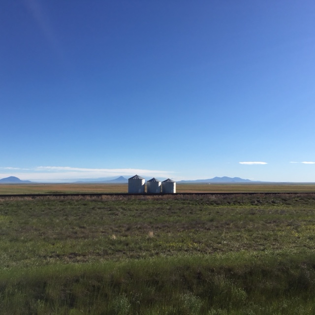
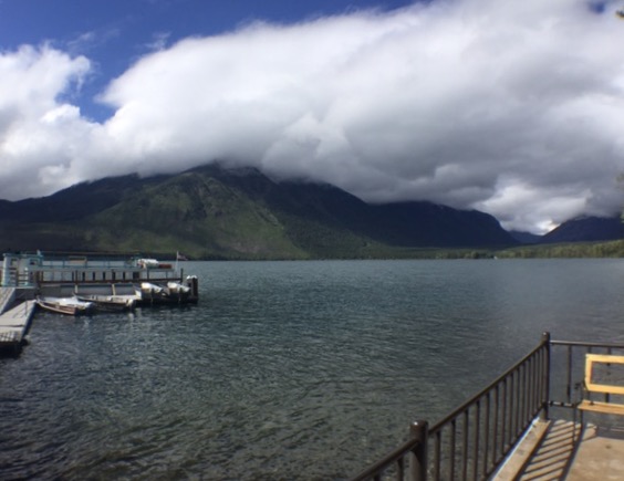
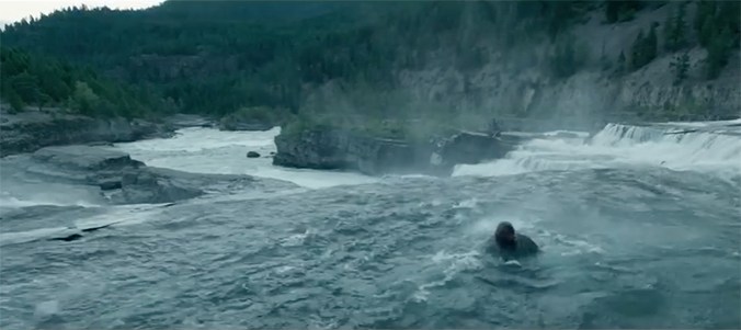
Storm clouds gathering along the “High Line” tracks we are following across Montana.

As we pulled into Shelby for lunch we checked the local weather (our intent was to move on to Chester – another 40 miles or so) and found there was a weather advisory for thunderstorms and hail. So, given that and the fatigue from yesterday, we decided to stop here and checked into the Comfort Inn – inexpensive, great and free wi fi (our crutch and hotel decider), guest laundry … The works. The maw of the stom appears to have missed Shelby but there is rain and thunder rolling around.

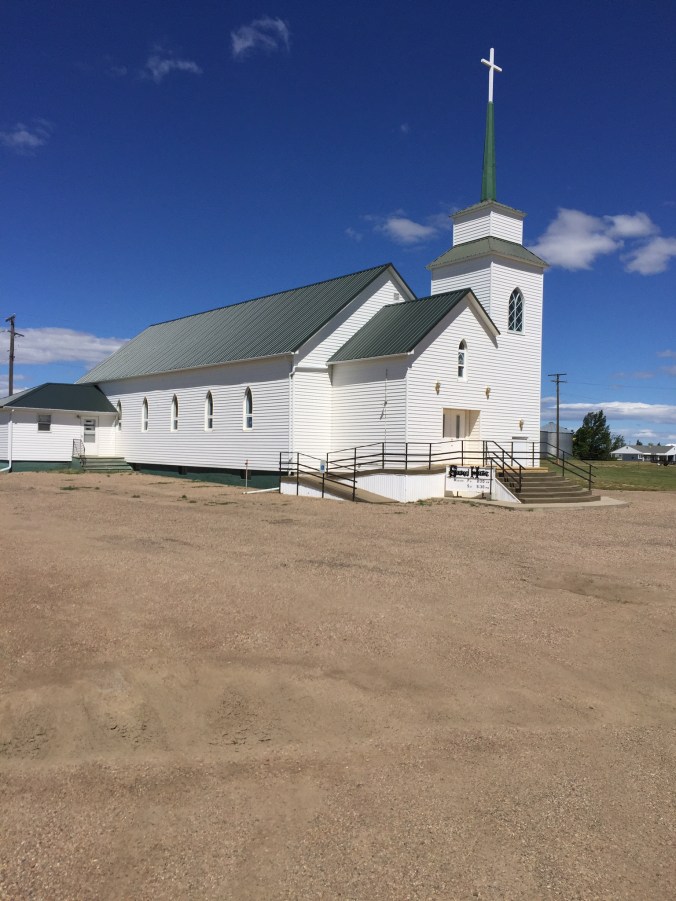
We followed a bit of the Lewis and Clark trail (Highway 2) and passed the town of Meriweather and the Lewis High School. The first part of the ride was through the Blackfeet Reservation then Rte. 2 just slides on due East. It is great to make mileage heading east after all the north and south squiggles we’ve been making since we left Washington.

image.jpeg

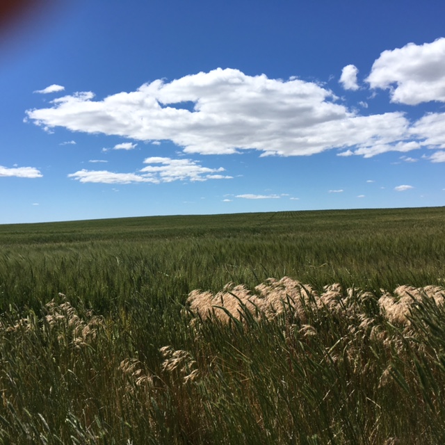
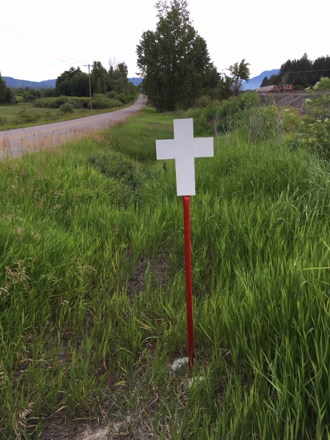
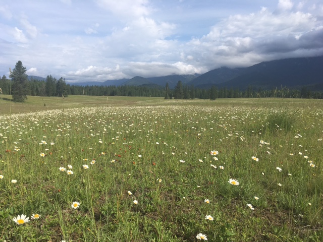
A little roadside color along Rte. 2

About yesterday’s ride on the Road to the Sun:  As I may have mentioned in the short post about it, the ride from Lake McDonald to Logan pass is the equivalent of a category 1 climb in the Tour de France (the guide book said it’s the equivalent of the stage up Les Deux-Alpes. (I repeated a description I heard that the climb to Logan pass was equal to L’Alpe d’Huez but that climb is in fact Hors Categorie – even harder). Yesterday there were a lot of drivers taking advantage of the pass’s opening so the last few miles were a little busy – there’s no shoulder on the windy two lane road but the road surface appears to be new.

image.jpeg

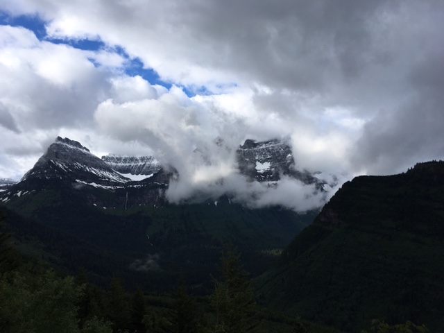
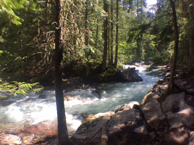
As we climbed higher we were in and out of clouds, some so dense you couldn’t see the road ahead.

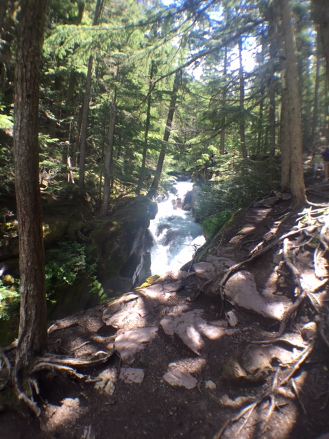
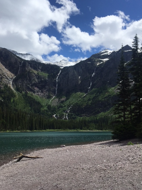
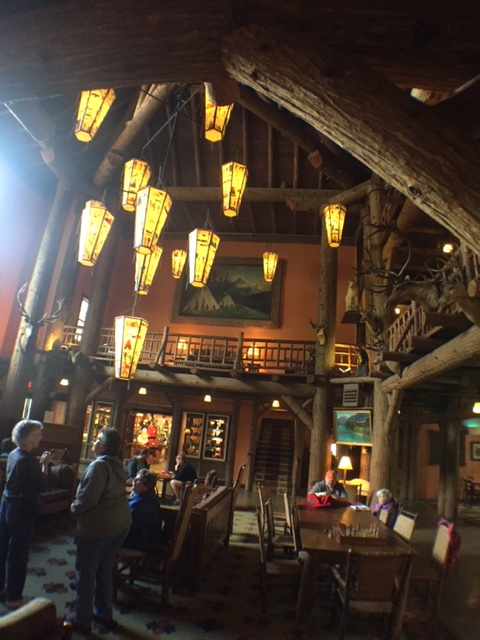
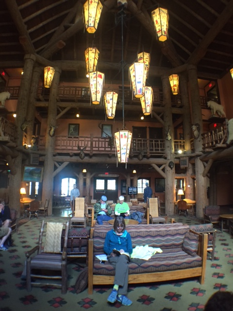
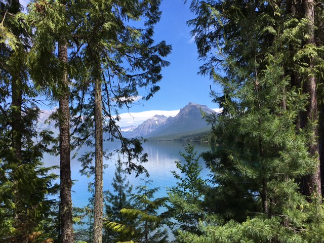
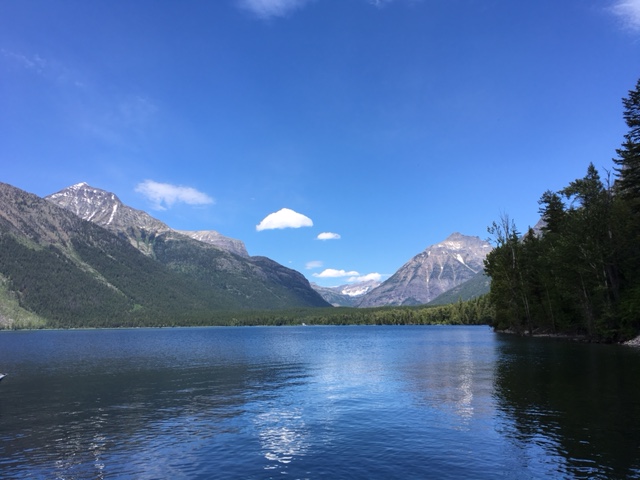
Winding ever upward, the road truly is, as our Warm Showers host Chuck said, the most beautiful bike ride we’ve ever seen – dense forest gives way to rocky vistas of 8 and 9 thousand feet peaks some still with snow. As we reached the top the wind picked up and it got quite cold but we had been aiming for the Visitors’ Center to warm up and prepare for the long downhill.  Of course, the center was not yet open and I guess we looked pitiful enough because a very nice couple (Mike and Barb from Seattle – also cyclists) invited us into their camper for some much needed heat and some hot cider. Again, the kindness of strangers – a lesson to us all.

image.jpeg

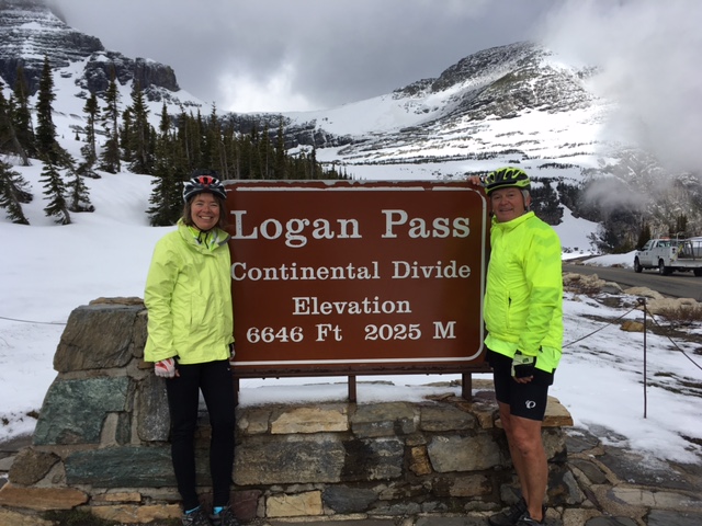
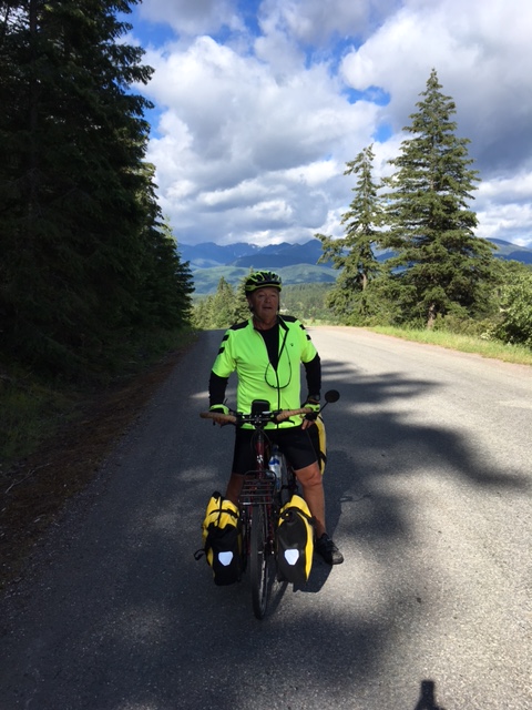
The hard climb done, we now head downhill toward the Mississippi

The downhill was indeed freezing – I stuffed a tee shirt under my jacket just to insulate my core – and we made quite a few stops just to keep from shivering. As I mentioned yesterday our route to Browning was taxing and on a day when we needed a lot of TLC at the end of the day, our hotel let us down by not offering the wi fi offered in their sign nor having hot enough water for showers, plus the room was freezing when we got there and took a while to warm up. Our dinner was a gourmand’s treat at Chez Subway and we quickly walked back and jumped right into bed.

We did get a free breakfast out of the deal and made PB and Nutella sandwiches for later.

image

Still plenty of snow up there. We saw some people with skis and a snowboard.

By the way, if you click on any of the small photos you can see it in large size.

Day 17 – Lake McDonald Lodge to Browning, MT

82 miles up and over the Continental Divide. We got up very early and found that the power was out at the lodge so we got dressed and packed in the dark. We climbed the 21 miles to the top of Logan Pass and it was COLD, and even colder going downhill on the East side. Once at the East entrance to the park we decided on an alternate route that ended up being hard climbing through a pretty monotonous landscape but at least there was not much traffic to contend with.

We ended up in Browning on the Blackfeet Reservation and checked into the first motel we could find and that was a mistake. We will post more details when we have a wi-fi connection and will also post stunning photos from around Logan Pass and the snowy mountains.

Day 16 – Last day at Lake McDonald

Huzzah!  We have received word that the pass is open so bright and early tomorrow we will get back on the road and have more to report on than how relaxed we’ve been. Our first challenge in the AM is to get over the Continental Divide by 11 AM when the Park Service closes the road to bicycles.  It’s roughly 21 miles but with an elevation change of over 3000 feet we expect quite a bit of Granny Gear usage.

Today we had to change rooms once again but will spend our last night in a very comfortable bed.  We have had some issues with the housekeeping staff including the latest which involved the sheet on our bunks that was, in one piece, a form fitting sheet and an upper sheet all together. The problem was that the staff is new and they put the upper part of the sheet on the bottom and then tucked in the form fitting part on top … So there was no way to get between the sheets!  The supervisor was very nice (Myra) and sympathized with us so we received a few freebies by being the wheel that squeaks!

We met a couple from California last night who are cycling around the US on a tandem. They had a broken spoke and the last we heard, they were limping back to Whitefish and the bike shop there to get their wheel taken care of.  Their predicament has made me think about broken spokes and even though we carry spares, to replace one while on the side of the road is a major task. I’m ordering a kit that will allow us to struggle through a bad spoke until we get to a bike shop and will pick it up late next week at General Delivery in Wolf Point.

here are more photos from our hike to Avalanche Lake yesterday


Day 15 – Yes, Still Lake McDonald

image.jpeg

Again zero progress across the US but we are having a very relaxing time! For us, our goal is not only to raise money for the Wright Foundation and to finish our trek on time but it is also about seeing a part of America we have never seen and enjoying doing it. So we don’t feel terribly guilty about taking some time off to experience the world we’re cycling through.

We had to move out of our cabin and are now in a dormitory room with a bunk bed!  Woo! The pass is still not open and no one has any insider info about when they will open it up. “Very soon” is all we hear.

We took the shuttle bus to Avalanche Creek and hiked a few miles into the dense cedar, hemlock and yew forest to Avalanche Lake. There were 3 waterfalls coming down into the lake and the water was blue and obviously very cold.

image.jpeg

If we had ever been feeling puffed up about the epic-ness of our trip, we would have been brought crashing back to earth after we met a British couple vacationing here who told us that a year ago their daughter ran across the US in 80 days! Now that really is epic. She averaged 40 miles a day and did a shorter route than ours but … Very impressive.

Tomorrow is forecast to be rain and cold again so we are lodge bound again.  Awww. More time by the fire reading! Also time to do some errands in the small town at the entrance to the park.

image.jpeg

Day 14 – Lake McDonald Lodge

0 miles today. That’s right zero, nada! 

Today was total rest and we spent most of the day looking at this fireplace in the lodge. We picked a great day to take a break since it was rainy and 48 degrees all day. It’s been healthy to give our bodies and brains some downtime. There is a certain amount of stress with getting on the road every morning and staying focused on directions, drivers, weather etc. and we were able to turn that off all day. (thanks to Stuart for the iPhone wide angle lens… slowly getting the learning curve down)

There is still no definitive word about the opening of the pass. Everyone we ask has a different opinion and Maja heard that the Park Service doesn’t like to give advance notice about it because there would be cars lined up from East gate to West gate. We think we can get out Friday or Saturday. The relaxation is wonderful and the park beautiful but we are, for now anyway, creatures of the road!

IMG_0724

Lake McDonald Lodge – A National Historic Landmark

FullSizeRender

A brief moment of sunshine over the lake

IMG_0726

Maja doing the only hard lifting we did today

Day 13 – Whitefish to Glacier

image

40 miles on nice roads and no “confusion.”

Our fantastic hosts, Rita and Chuck, started us off with a hot breakfast and coffee this morning (other Warm Showers hosts take notes!). Tom, who also shared in their hospitality, took off early hoping to get 100 miles to the Canadian border on his Great Divide Race today – from the Mexican border with New Mexico all the way to Banff, Alberta, solo, on Park Service roads.

We casually embarked on a very pleasant, short, touring type ride today to Lake McDonald Lodge in Glacier National Park.

image.jpeg

We like this message and we guess others do too because litter is a lot less in Montana.

The road was mostly clear with the added benefit that drivers around Whitefish are used to dealing with bikes so the fear factor was lessened quite a bit. We did have an unpleasant 2.5 mile stretch through the forest on a rough gravel road where our speed was minimal but after that we sailed into the Park with smiles on our faces.

image.jpeg

Our first views of Lake McDonald.  It doesn’t get better than this!

We planned on taking a rest day tomorrow but now there is uncertainty when Logan Pass over the Continental Divide will be open so at the moment it is unclear when we will leave. There is an alternate route but it’s on the shoulder of Route 2, not something we are excited about. Time, weather, road crews will all tell in then end.

In the meantime, we are happy and very comfortable here in the Lodge.

image.jpeg

One of many roadside crosses–there are way too many of these on the roads. Maybe an indication that a 70 mph speed limit on two lane roads is a bit too high.

image.jpeg

Our view of Lake McDonald from the Lodge


image.jpeg

Our home away from home. Tenting at our “warm showers” hosts in Whitefish

Day 12 – Eureka to Whitefish

56 miles today

Good start this morning after a restful night in the Silverado Hotel in Eureka. We back tracked our in-error route yesterday then at the end of town turned off the highway onto a small road that took us through forests … And no traffic.

image

After 17 miles or so this pleasant way dumped us back on the highway. It was Sunday so there was not too much traffic and no trucks but the shoulder was narrow.

We had lunch at the post office in Olney and hopped back on the road for the final 20 miles. Sadly, at that point the condition of Route 93 deteriorated badly making the biking very uncomfortable. It seems that everyone in Montana either drives a pick up or is towing some huge camper or trailer causing anxiety every time one passes us particularly if there happens to be oncoming traffic squeezing us all close together.image

There are many crosses planted along the road, simple, small steel crosses painted white on 4′ posts. The speed limit on this rough road was 70 and we wondered if reducing the posted speeds might result in fewer crosses.

To make matters worse, the altitude profile we had seen for today’s ride failed to show several of the hills at the very end of our ride. These are the kinds of challenges that make me sigh and say “Really?”

We arrived mid afternoon in Whitefish and found our hosts. Turns out Rita, our host, knows Maja’s swim coach at Dartmouth.  Small world department.

image

We visited our first Frank Lloyd Wright building of the trip, a small office building he designed for a friend of his in 1958. Wright died in ’59 so never saw the completed building. It has seen quite a bit of remodeling but is still known as “The Frank Lloyd Wright Building.”

image

Maja’s addendum:

As I look back at our rides, there appear to be two categories:  the “stop and smell the roses rides” and the “get from point A to point B” rides. Today was definitely the latter.  When we started the temps were in the mid 40s, so quite chilly. Luckily, it was partly sunny for the ride, so we warmed up. The ride on the two lane highway with the 70 mph speed limit was white knuckle most of the way. I’m sure the views were very beautiful, be we were totally focused on the road. We were happy to get to Whitefish! Our “warm shower hosts” are great and spoiled us with beer and snacks before we headed into town for dinner. There’s another cyclist staying here: an Aussie who is just about to finish the Mexico to Canada Continental Divide ride all on forest trails/roads. He averages about 100 miles a day. Wow! We also met a really interesting character in Eureka, who I think should be played by Johnny Depp, if there’s ever a movie made about him. He had a coonskin hat (tail and all), and approached us in the parking lot when he saw our bikes.  He had some interesting stories to tell about his architecture as well as fund raising experiences (said he raised $15 million). Very eccentric. We gave him our Bike Wright card.  So our string of meeting interesting people continues. That said, Montana gets demerits from a bike toting pick up driver who made fun of us in Eureka when we asked him for directions to the motel we wanted to stay at and he realized we had biked all the way through town, downhill, only to have to return the same way we came. He certainly takes the “Schadenfreude” award.  Looking forward to a short ride and some rest at Glacier!!!

Day 11 – Libby to Eureka

82 miles today.

That figure is as bit misleading since as we tried our best to leave Libby we got (in the words of our rescuer Fred from yesterday) “slightly confused.” The maps we had and our GPS didn’t sync up so we spent a bit of time and distance figuring things out. Google Maps is not always accurate but as a corroborating source it served us today.  We did finally make it out of town after an egg McMuffin equivalent at the local grocery store and sandwich provisions for later in the day. The road we were on paralleled the river and train tracks (the same tracks on which the long trains ran all last night with air horns blasting and, yes, they kept me awake! Train whistles may be a plaintiff sound in the country music vocabulary and each train is different but they are loud!).

After 15 miles on this very quiet road we crossed the river to take an alternate route around Lake Koocanusa (Kootenai+Canada+USA) recommended to us by some Canadian cyclists we met yesterday.

image

Starting the Lake Koocanusa Alternative Route

It was a very wise choice! The road was longer by 4 or 5 miles but totally our own with no lumber trucks and very little other traffic. There were warnings about grizzly sightings but we saw not a single animal of any sort (except for the vultures, crows and Ospreys). The way was hilly, with a monster up hill at the very beginning of our ride as far as the visitor center for the Libby Dam. After that we had numerous ups and downs for 45 miles but, as I said, we had the road to ourselves so could often ride side by side… And actually talk instead of listening for approaching cars and trucks.

image

Libby Dam

We’ve settled on a good food plan so integrate breaks with lunch and/or bananas and good old Cliff Bars.

image

Lunch al fresca

So… After 45 miles we crossed the river on a new and very wide bridge high above the river. The cross wind was impressive and being more or less alone on that long span with the wind actually singing through the railings was a little surreal. After the bridge we had 16 miles or so to Eureka but, once again, we had to navigate carefully the space on the shoulder between the rumble strips and the loose gravel with cars and trucks whizzing by at 70 miles an hour (not a relaxing bicycle ride).

The last miles into Eureka had no shoulder at all and, as you might expect at the shank end of a long day we were not in a good mental space to deal with the cars.  Anyway, we made it to Eureka and, trusting Apple Maps, road down a long hill all the way through town in hopes of finding our hotel.  Predictably, once we asked at the gas station we were told that the hotel was, in reality, at the upper end of town so, not happy, we biked back up the long hill and checked into a hotel. Only then did we find that this place had no wi-fi!  (Really! I say.) So we rode a little farther and got a room with wi fi at a different place. Gambling is legal in Montana so every little place (hotel, restaurant etc.) has a “casino” – they really only offer one armed bandits and computer poker etc.

We are fed and back in our room and will head to Whitefish tomorrow and will stay with another Warm Showers host.

Day 10 – Clark Fork to Libby, MT

After a good night’s rest we loaded all our panniers (a place for everything …) and biked to the local bakery/cafe for breakfast burritos, sandwiches for lunch and some trail mix. Then we hit the road in a light rain. The forecast was rain all day but that never materialized, it was just clouds and cool temps. We took an alternate route that paralleled the horrible Hwy. 200 and were soon zipping through fields and farms and entered Montana.

image.jpeg

Typical scenery for the day

The last mile or so of this road before it re-joined the 200 was gravel and the joy of zooming downhill was tempered by the washboard road and occasional potholes. Rounding a bend we flew into and out of the town of Heron where we had our first dog chasing incident of the trip… It all ended well when he/she saw we were pretty fast prey! The road continued in gravel and we went up and down for a while until we realized we should have turned left before even getting into Heron. We stood at a Y in the road trying to figure out where we were and how to get back on track – retracing our route back down and up was not appealing. Along the road came a beat up pick up and we flagged the driver down to ask for help since we were “lost.”

“You’re never lost,” he said. “Only slightly confused!” His name is Fred and he lives off the grid at the end of that gravel road. Without any hesitation he cleared space for our bikes in the tool-and-equipment-filled bed of his truck and lashed everything in securely.

image

Fred tying in our bikes

We crowded into the cab (it was a mini pick up) and Fred drove us back into Heron where we unloaded at the turn we should have made in the first place. As we thanked him for his kindness he said he wondered why God had made him leave his house at that time today. I guess it was to help us!

The rest of the ride was quiet on a nice road leading to Libby. We stopped outside of town and Maja walked down to the Kootenai Falls (think DiCaprio’s escape over the falls in the Revenant…

image

Kootenai Falls as we saw them

rev

Leo DiCaprio’s character shooting the rapids at Kootenai Falls in The Revenant.

The scene was filmed at Kootenai). We are camping at the Two Bit Campground in Libby and head for Eureka tomorrow and are now in the Mountain time zone.